
Hot Springs County topographic map
Interactive map
Click on the map to display elevation.
About this map
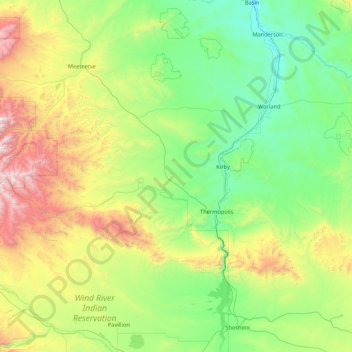
Name: Hot Springs County topographic map, elevation, terrain.
Location: Hot Springs County, Wyoming, United States of America (43.45932 -109.31313 44.08096 -107.59544)
Average elevation: 1,745 m
Minimum elevation: 1,170 m
Maximum elevation: 3,780 m