
Mason County topographic map
Interactive map
Click on the map to display elevation.
About this map
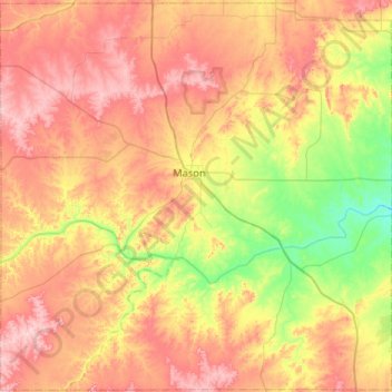
Name: Mason County topographic map, elevation, terrain.
Location: Mason County, Texas, United States of America (30.49821 -99.48460 30.94108 -98.96321)
Average elevation: 501 m
Minimum elevation: 358 m
Maximum elevation: 658 m
Other topographic maps
Click on a map to view its topography, its elevation and its terrain.