
Grayson County topographic map
Interactive map
Click on the map to display elevation.
About this map
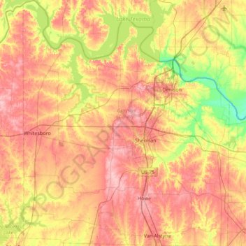
Name: Grayson County topographic map, elevation, terrain.
Location: Grayson County, Texas, United States of America (33.39789 -96.94507 33.95835 -96.37940)
Average elevation: 214 m
Minimum elevation: 147 m
Maximum elevation: 276 m
Other topographic maps
Click on a map to view its topography, its elevation and its terrain.