
Rotherham topographic map
Interactive map
Click on the map to display elevation.
About this map
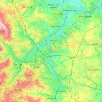
Name: Rotherham topographic map, elevation, terrain.
Location: Rotherham, Yorkshire and the Humber, England, United Kingdom (53.30155 -1.45679 53.51531 -1.11514)
Average elevation: 101 m
Minimum elevation: -13 m
Maximum elevation: 314 m