
Nzérékoré Region topographic map
Interactive map
Click on the map to display elevation.
About this map
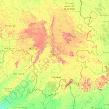
Name: Nzérékoré Region topographic map, elevation, terrain.
Location: Nzérékoré Region, Guinea (7.19060 -10.70186 9.58550 -7.63792)
Average elevation: 490 m
Minimum elevation: 129 m
Maximum elevation: 1,622 m
Other topographic maps
Click on a map to view its topography, its elevation and its terrain.