
Bergerie de Ballone topographic map
Interactive map
Click on the map to display elevation.
About this map
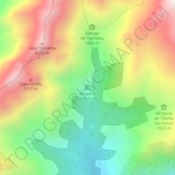
Name: Bergerie de Ballone topographic map, elevation, terrain.
Average elevation: 1,710 m
Minimum elevation: 1,226 m
Maximum elevation: 2,304 m
Other topographic maps
Click on a map to view its topography, its elevation and its terrain.
Colga
France > Corsica > Albertacce
Colga, Albertacce, Corte, Haute-Corse, Corsica, Metropolitan France, 20224, France
Average elevation: 1,290 m