
Tizi Ouzou topographic map
Interactive map
Click on the map to display elevation.
About this map
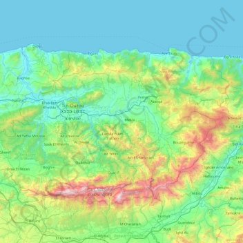
Name: Tizi Ouzou topographic map, elevation, terrain.
Location: Tizi Ouzou, Algeria (36.45253 3.71543 36.91074 4.65296)
Average elevation: 429 m
Minimum elevation: -1 m
Maximum elevation: 2,256 m
Other topographic maps
Click on a map to view its topography, its elevation and its terrain.