
Leon County topographic map
Interactive map
Click on the map to display elevation.
About this map
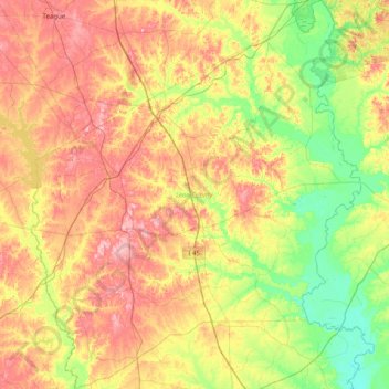
Name: Leon County topographic map, elevation, terrain.
Location: Leon County, Texas, United States of America (30.97397 -96.33121 31.65413 -95.65529)
Average elevation: 105 m
Minimum elevation: 42 m
Maximum elevation: 187 m
Other topographic maps
Click on a map to view its topography, its elevation and its terrain.