
Khartoum topographic map
Interactive map
Click on the map to display elevation.
About this map
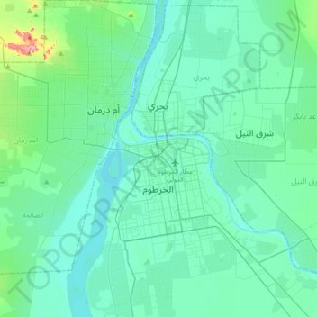
Name: Khartoum topographic map, elevation, terrain.
Location: Khartoum, Khartoum State, ١١١١١, Sudan (15.43333 32.37565 15.75333 32.69565)
Average elevation: 388 m
Minimum elevation: 372 m
Maximum elevation: 495 m
Khartoum is relatively flat, at elevation 385 m (1,263 ft), as the Nile flows northeast past Omdurman to Shendi, at elevation 364 m (1,194 ft)about 101 miles (163 km) away.