
Ernakulam topographic map
Interactive map
Click on the map to display elevation.
Ernakulam
The City of Ernakulam is situated in the Ernakulam District of Central Kerala in India. Ernakulam is located at 9°59′N 76°17′E / 9.98°N 76.28°E / 9.98; 76.28. It has an average elevation of 4 m (13 ft).
About this map
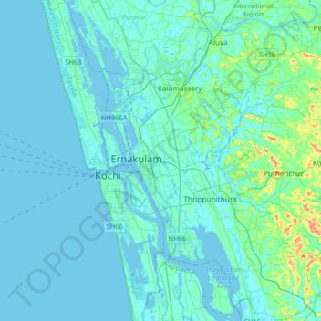
Name: Ernakulam topographic map, elevation, terrain.
Average elevation: 8 m
Minimum elevation: -4 m
Maximum elevation: 80 m