
Greer County topographic map
Interactive map
Click on the map to display elevation.
About this map
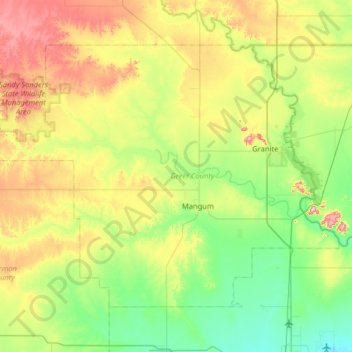
Name: Greer County topographic map, elevation, terrain.
Location: Greer County, Oklahoma, United States of America (34.72463 -99.88827 35.11698 -99.24667)
Average elevation: 504 m
Minimum elevation: 411 m
Maximum elevation: 705 m
Other topographic maps
Click on a map to view its topography, its elevation and its terrain.