
Kendal topographic map
Interactive map
Click on the map to display elevation.
About this map
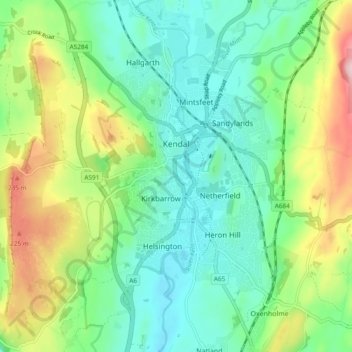
Name: Kendal topographic map, elevation, terrain.
Location: Kendal, South Lakeland, Cumbria, England, United Kingdom (54.29620 -2.76906 54.35149 -2.70525)
Average elevation: 112 m
Minimum elevation: 32 m
Maximum elevation: 290 m