
Santos Bay topographic map
Interactive map
Click on the map to display elevation.
About this map
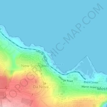
Name: Santos Bay topographic map, elevation, terrain.
Average elevation: 36 m
Minimum elevation: 0 m
Maximum elevation: 160 m
Other topographic maps
Click on a map to view its topography, its elevation and its terrain.
Witwater
RSA > Western Cape > Mossel Bay Local Municipality
Witwater, Mossel Bay Local Municipality, Garden Route District Municipality, Western Cape, RSA
Average elevation: 257 m