
Midvaal Ward 13 topographic map
Interactive map
Click on the map to display elevation.
About this map
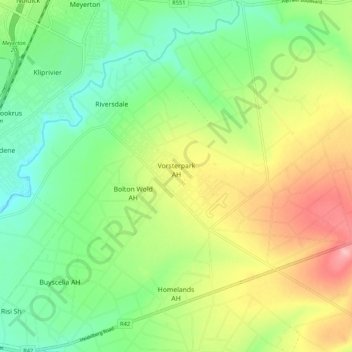
Name: Midvaal Ward 13 topographic map, elevation, terrain.
Average elevation: 1,486 m
Minimum elevation: 1,435 m
Maximum elevation: 1,565 m
Other topographic maps
Click on a map to view its topography, its elevation and its terrain.
Suikerbosrand Nature Reserve
RSA > Gauteng > Midvaal Local Municipality
Suikerbosrand Nature Reserve, Tourist Route, Midvaal Ward 4, Midvaal Local Municipality, Sedibeng District Municipality, Gauteng, RSA
Average elevation: 1,620 m