
พัทยา topographic map
Interactive map
Click on the map to display elevation.
About this map
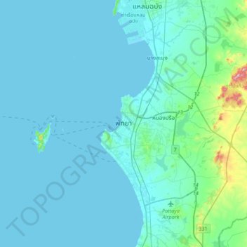
Name: พัทยา topographic map, elevation, terrain.
Location: พัทยา, จังหวัดชลบุรี, 20150, Thailand (12.77194 100.74095 13.09194 101.06095)
Average elevation: 34 m
Minimum elevation: 0 m
Maximum elevation: 334 m
Other topographic maps
Click on a map to view its topography, its elevation and its terrain.
เกาะล้าน
Thailand > จังหวัดชลบุรี > พัทยา
เกาะล้าน, พัทยา, จังหวัดชลบุรี, Thailand
Average elevation: 11 m