
Banghoek Private Nature Reserve topographic map
Interactive map
Click on the map to display elevation.
About this map
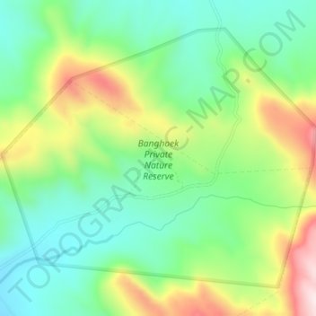
Name: Banghoek Private Nature Reserve topographic map, elevation, terrain.
Average elevation: 310 m
Minimum elevation: 130 m
Maximum elevation: 637 m
Other topographic maps
Click on a map to view its topography, its elevation and its terrain.
Vier en Twintig Riviere
RSA > Western Cape > Bergrivier Local Municipality
Vier en Twintig Riviere, Bergrivier Local Municipality, West Coast District Municipality, Western Cape, RSA
Average elevation: 62 m
Rocherpan Nature Reserve
RSA > Western Cape > Bergrivier Local Municipality
Rocherpan Nature Reserve, Main, Bergrivier Ward 7, Bergrivier Local Municipality, West Coast District Municipality, Western Cape, 7365, RSA
Average elevation: 13 m