
North Engilchek Glacier topographic map
Interactive map
Click on the map to display elevation.
About this map
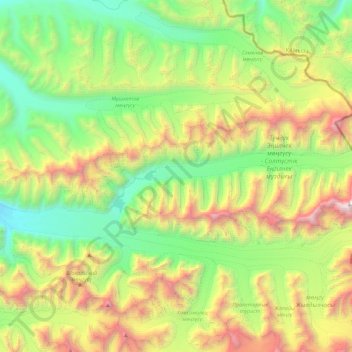
Name: North Engilchek Glacier topographic map, elevation, terrain.
Location: North Engilchek Glacier, Issyk-Kul Region, Kyrgyzstan (42.18531 79.82469 42.26637 80.27448)
Average elevation: 4,153 m
Minimum elevation: 3,064 m
Maximum elevation: 6,332 m
Other topographic maps
Click on a map to view its topography, its elevation and its terrain.
Терскей-Ала-Тоо
Kyrgyzstan > Issyk-Kul Region > Jeti-Ögüz District
Терскей-Ала-Тоо, Jeti-Ögüz District, Issyk-Kul Region, Kyrgyzstan
Average elevation: 2,939 m
Chu River
Chu River, Issyk-Kul Region, Kyrgyzstan
Average elevation: 1,835 m