
Komati River topographic map
Interactive map
Click on the map to display elevation.
About this map
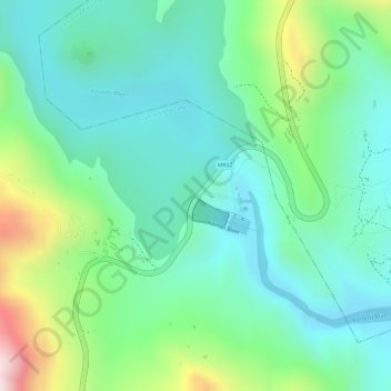
Name: Komati River topographic map, elevation, terrain.
Location: Komati River, Inkhundla Nkhaba, Hhohho, Eswatini (-26.07856 31.25824 -26.07786 31.26172)
Average elevation: 648 m
Minimum elevation: 515 m
Maximum elevation: 973 m
Other topographic maps
Click on a map to view its topography, its elevation and its terrain.