
Victoria Falls topographic map
Interactive map
Click on the map to display elevation.
About this map
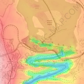
Name: Victoria Falls topographic map, elevation, terrain.
Location: Victoria Falls, Hwange, Matabeleland North, 00236, Zimbabwe (-17.92447 25.85033 -17.92314 25.85392)
Average elevation: 877 m
Minimum elevation: 758 m
Maximum elevation: 932 m
Other topographic maps
Click on a map to view its topography, its elevation and its terrain.
Tsholotsho
Tsholotsho, Matabeleland North, Zimbabwe
Average elevation: 1,047 m
Zambezi River
Zambezi River, Binga, Matabeleland North, 00236, Zimbabwe
Average elevation: 1,017 m
Hwange
Hwange, Matabeleland North, 00236, Zimbabwe
Average elevation: 968 m
Hwange National Park
Hwange National Park, Hwange, Matabeleland North, Zimbabwe
Average elevation: 1,000 m