
Hennepin County topographic map
Interactive map
Click on the map to display elevation.
About this map
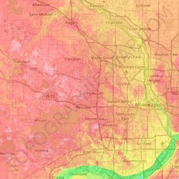
Name: Hennepin County topographic map, elevation, terrain.
Location: Hennepin County, Minnesota, United States of America (44.78513 -93.77020 45.24660 -93.17687)
Average elevation: 280 m
Minimum elevation: 190 m
Maximum elevation: 340 m
Other topographic maps
Click on a map to view its topography, its elevation and its terrain.