
Tele River topographic map
Interactive map
Click on the map to display elevation.
About this map
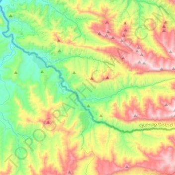
Name: Tele River topographic map, elevation, terrain.
Location: Tele River, Quthing District, Lesotho (-30.61909 27.62135 -30.50435 27.88030)
Average elevation: 1,981 m
Minimum elevation: 1,426 m
Maximum elevation: 2,881 m
Other topographic maps
Click on a map to view its topography, its elevation and its terrain.
Moyeni (Quthing)
Moyeni (Quthing), Quthing District, Lesotho
Average elevation: 1,644 m