
Rostov Oblast topographic map
Interactive map
Click on the map to display elevation.
About this map
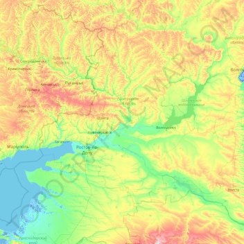
Name: Rostov Oblast topographic map, elevation, terrain.
Location: Rostov Oblast, South Federal District, Russia (45.06225 38.23579 50.18225 43.35579)
Average elevation: 103 m
Minimum elevation: -11 m
Maximum elevation: 605 m
Other topographic maps
Click on a map to view its topography, its elevation and its terrain.
Zernograd
Russia > Rostov Oblast > Zernogradsky District
Zernograd, Зерноградское городское поселение, Zernogradsky District, Rostov Oblast, Southern Federal District, 347740, Russia
Average elevation: 87 m