
Lampung topographic map
Interactive map
Click on the map to display elevation.
About this map
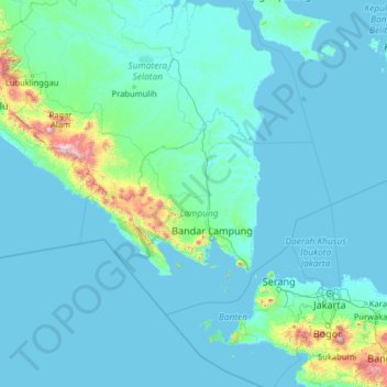
Name: Lampung topographic map, elevation, terrain.
Location: Lampung, Indonesia (-7.41550 102.46730 -2.29550 107.58730)
Average elevation: 99 m
Minimum elevation: -2 m
Maximum elevation: 2,871 m
Other topographic maps
Click on a map to view its topography, its elevation and its terrain.