
Kigali City topographic map
Interactive map
Click on the map to display elevation.
About this map
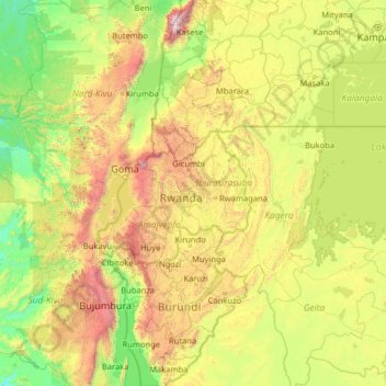
Name: Kigali City topographic map, elevation, terrain.
Location: Kigali City, Rwanda (-4.44596 27.56968 0.67404 32.68968)
Average elevation: 1,307 m
Minimum elevation: 574 m
Maximum elevation: 4,825 m
Other topographic maps
Click on a map to view its topography, its elevation and its terrain.
Kigali
Rwanda > Kigali City > Nyarugenge District
Kigali, Nyarugenge District, Kigali City, Rwanda
Average elevation: 1,530 m
Kimihurura
Rwanda > Kigali City > Gasabo District
Kimihurura, Gasabo District, Kigali City, Rwanda
Average elevation: 1,443 m