
Harris County topographic map
Interactive map
Click on the map to display elevation.
About this map
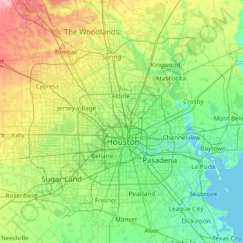
Name: Harris County topographic map, elevation, terrain.
Location: Harris County, Texas, United States of America (29.49734 -95.96085 30.17073 -94.90846)
Average elevation: 28 m
Minimum elevation: -3 m
Maximum elevation: 126 m
Other topographic maps
Click on a map to view its topography, its elevation and its terrain.