
Capital District topographic map
Interactive map
Click on the map to display elevation.
About this map
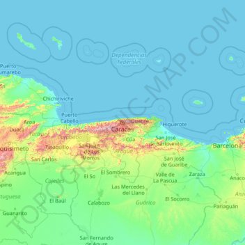
Name: Capital District topographic map, elevation, terrain.
Location: Capital District, Venezuela (7.94535 -69.47472 13.06535 -64.35472)
Average elevation: 117 m
Minimum elevation: -1 m
Maximum elevation: 2,444 m
Other topographic maps
Click on a map to view its topography, its elevation and its terrain.
Caracas
Venezuela > Capital District > Municipio Libertador
Caracas is contained entirely within a valley of the Venezuelan Central Range, and is separated from the Caribbean coast by a roughly 15-kilometer (9 mi) expanse of El Ávila National Park. The valley is relatively small and quite irregular, and the altitude varies from between 870 and 1,043 meters (2,854 and…
Average elevation: 727 m