
Mareetsane topographic map
Interactive map
Click on the map to display elevation.
About this map
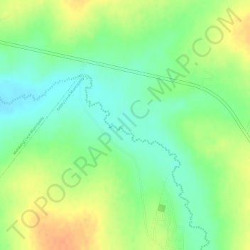
Name: Mareetsane topographic map, elevation, terrain.
Average elevation: 1,318 m
Minimum elevation: 1,298 m
Maximum elevation: 1,338 m
Other topographic maps
Click on a map to view its topography, its elevation and its terrain.
Rooigrond
South Africa > North West > Mahikeng Local Municipality > Rooigrond
Rooigrond, Mahikeng Local Municipality, Ngaka Modiri Molema District Municipality, North West, South Africa
Average elevation: 1,408 m