
Washington County topographic map
Interactive map
Click on the map to display elevation.
About this map
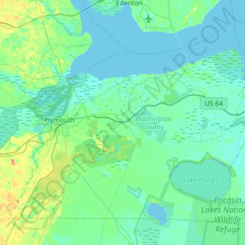
Name: Washington County topographic map, elevation, terrain.
Location: Washington County, North Carolina, United States of America (35.69759 -76.84512 36.02636 -76.35365)
Average elevation: 4 m
Minimum elevation: -2 m
Maximum elevation: 25 m
Other topographic maps
Click on a map to view its topography, its elevation and its terrain.