
Changde City topographic map
Interactive map
Click on the map to display elevation.
About this map
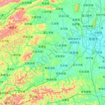
Name: Changde City topographic map, elevation, terrain.
Location: Changde City, Taoyuan County, Hunan, China (28.40581 110.84680 29.40115 111.60625)
Average elevation: 229 m
Minimum elevation: 24 m
Maximum elevation: 1,209 m