
Mogale City Ward 28 topographic map
Interactive map
Click on the map to display elevation.
About this map
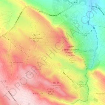
Name: Mogale City Ward 28 topographic map, elevation, terrain.
Average elevation: 1,640 m
Minimum elevation: 1,448 m
Maximum elevation: 1,798 m
Other topographic maps
Click on a map to view its topography, its elevation and its terrain.
Mogale City Ward 27
RSA > Gauteng > Mogale City Local Municipality
Mogale City Ward 27, Mogale City Local Municipality, West Rand District Municipality, Gauteng, RSA
Average elevation: 1,602 m