
Bushman's River topographic map
Interactive map
Click on the map to display elevation.
About this map
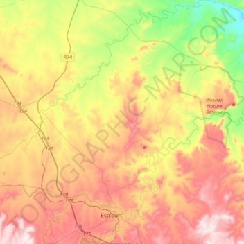
Name: Bushman's River topographic map, elevation, terrain.
Average elevation: 1,089 m
Minimum elevation: 702 m
Maximum elevation: 1,496 m
Other topographic maps
Click on a map to view its topography, its elevation and its terrain.
Umtshezi Ward 8
RSA > KwaZulu-Natal > Umtshezi Local Municipality
Umtshezi Ward 8, Umtshezi Local Municipality, Uthukela District Municipality, KwaZulu-Natal, RSA
Average elevation: 1,037 m