
Yalong River topographic map
Interactive map
Click on the map to display elevation.
About this map
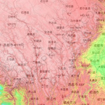
Name: Yalong River topographic map, elevation, terrain.
Average elevation: 3,378 m
Minimum elevation: 195 m
Maximum elevation: 6,833 m
Other topographic maps
Click on a map to view its topography, its elevation and its terrain.
Jialing River
Jialing River, Gaoping District, Nanchong City, Sichuan, 400000, PRC
Average elevation: 516 m
Hanshui River
Hanshui River, Dachuan District, Dazhou City, Sichuan, PRC
Average elevation: 423 m