
Highest Point topographic map
Interactive map
Click on the map to display elevation.
About this map
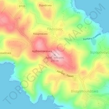
Name: Highest Point topographic map, elevation, terrain.
Average elevation: 99 m
Minimum elevation: 0 m
Maximum elevation: 228 m
Other topographic maps
Click on a map to view its topography, its elevation and its terrain.
Monemvasia
Greece > Peloponnese, West Greece and Ionian Sea
Monemvasia, Δήμος Μονεμβασιάς, Lakonia Regional Unit, Peloponnese Region, Peloponnese, West Greece and Ionian Sea, Greece
Average elevation: 5 m
Mount Ainos
Greece > Peloponnese, West Greece and Ionian Sea
Mount Ainos, Δήμος Κεφαλληνίας, Kefallonia Regional Unit, Ionian Islands Region, Peloponnese, West Greece and Ionian Sea, Greece
Average elevation: 1,234 m