
Edgeøya topographic map
Interactive map
Click on the map to display elevation.
About this map
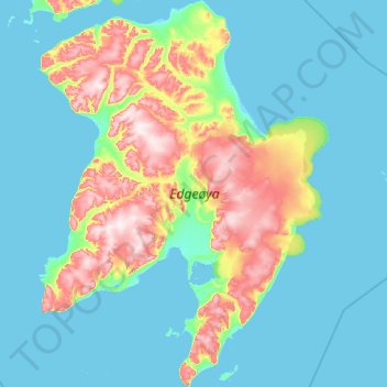
Name: Edgeøya topographic map, elevation, terrain.
Location: Edgeøya, Svalbard, Norway (77.24124 20.78641 78.25768 24.32681)
Average elevation: 85 m
Minimum elevation: -2 m
Maximum elevation: 579 m
Other topographic maps
Click on a map to view its topography, its elevation and its terrain.