
Kvitøya topographic map
Interactive map
Click on the map to display elevation.
About this map
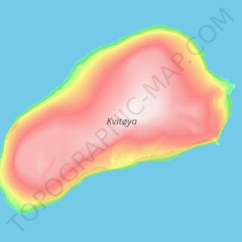
Name: Kvitøya topographic map, elevation, terrain.
Location: Kvitøya, Svalbard, Norway (80.04144 31.42576 80.31155 33.51425)
Average elevation: 95 m
Minimum elevation: 0 m
Maximum elevation: 404 m
Other topographic maps
Click on a map to view its topography, its elevation and its terrain.