
Goromonzi topographic map
Interactive map
Click on the map to display elevation.
About this map
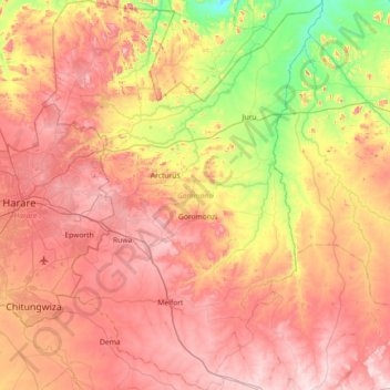
Name: Goromonzi topographic map, elevation, terrain.
Location: Goromonzi, Mashonaland East, Zimbabwe (-18.16168 31.08788 -17.47483 31.60868)
Average elevation: 1,396 m
Minimum elevation: 1,077 m
Maximum elevation: 1,692 m
Other topographic maps
Click on a map to view its topography, its elevation and its terrain.
Mutungagore
Mutungagore, Goromonzi, Mashonaland East, Zimbabwe
Average elevation: 1,383 m