
Østfold topographic map
Interactive map
Click on the map to display elevation.
About this map
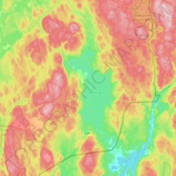
Name: Østfold topographic map, elevation, terrain.
Location: Rømskog, Østfold, 1950, Norway (59.62387 11.65064 59.79059 11.94600)
Average elevation: 223 m
Minimum elevation: 111 m
Maximum elevation: 342 m
Other topographic maps
Click on a map to view its topography, its elevation and its terrain.