
Kinross topographic map
Interactive map
Click on the map to display elevation.
About this map
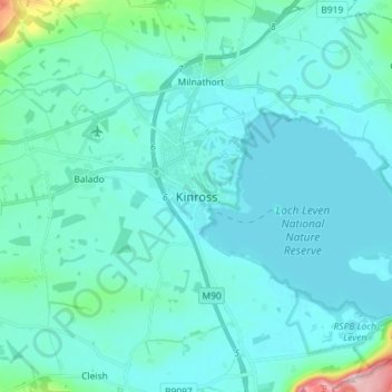
Name: Kinross topographic map, elevation, terrain.
Location: Kinross, Perth and Kinross, Scotland, KY13 8AL, United Kingdom (56.16337 -3.46149 56.24337 -3.38149)
Average elevation: 129 m
Minimum elevation: 103 m
Maximum elevation: 352 m
Other topographic maps
Click on a map to view its topography, its elevation and its terrain.
Westown
United Kingdom > Scotland > Perth and Kinross
Westown, Perth and Kinross, Scotland, PH2 7SU, United Kingdom
Average elevation: 30 m
Dunkeld
United Kingdom > Scotland > Perth and Kinross
Dunkeld, Perth and Kinross, Scotland, PH8 0AL, United Kingdom
Average elevation: 190 m
Blair Atholl
United Kingdom > Scotland > Perth and Kinross > Blair Atholl
Blair Atholl, Perth and Kinross, Scotland, PH18 5TQ, United Kingdom
Average elevation: 245 m