
Renton topographic map
Interactive map
Click on the map to display elevation.
About this map
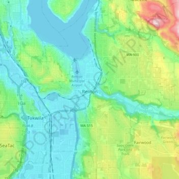
Name: Renton topographic map, elevation, terrain.
Location: Renton, King County, Washington, United States of America (47.42298 -122.25422 47.53937 -122.12029)
Average elevation: 83 m
Minimum elevation: -1 m
Maximum elevation: 346 m