
Malden topographic map
Interactive map
Click on the map to display elevation.
About this map
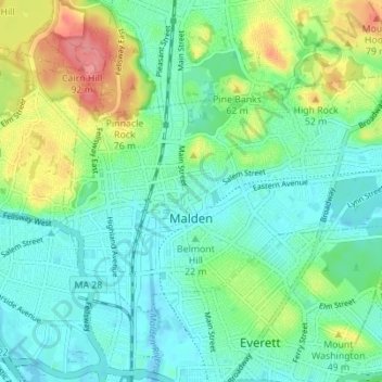
Name: Malden topographic map, elevation, terrain.
Average elevation: 25 m
Minimum elevation: -2 m
Maximum elevation: 85 m
Malden is bordered by Melrose on the north, Stoneham on the northwest, Medford on the west, Everett on the south, Revere on the east, and Saugus on the northeast. Boojum Rock located in the north west corner of Malden inside the Middlesex Fells Reservation is the highest point in Malden with an elevation of approximately 275 feet.