
Province of Huaral topographic map
Interactive map
Click on the map to display elevation.
About this map
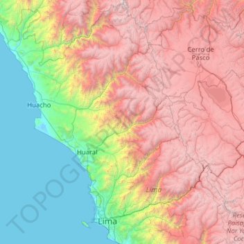
Name: Province of Huaral topographic map, elevation, terrain.
Location: Province of Huaral, Ihuarí, Province of Huaral, Lima, Peru (-11.27000 -76.93667 -11.23000 -76.89667)
Average elevation: 2,355 m
Minimum elevation: 1,643 m
Maximum elevation: 3,149 m