
Somerville topographic map
Interactive map
Click on the map to display elevation.
About this map
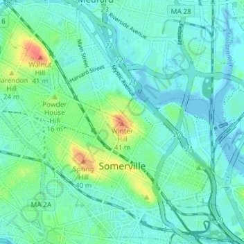
Name: Somerville topographic map, elevation, terrain.
Average elevation: 11 m
Minimum elevation: -5 m
Maximum elevation: 47 m
Somerville's commercial property is not concentrated in a recognized downtown central business district but instead is spread over many different nodes or corridors of business activity. The difference in character ranges from the vibrant nightlife, live music and theaters of Davis Square to the large scale retail and highway access of Assembly Square. This spatial allocation is directly related to the early influence of rail and streetcar systems which caused economic activity to occur at stops. The other key factor in the creation of commercial squares is the area's topography. The numerous hills making up Somerville's landscape determined where road networks would allow neighborhood commercial development.