
Sol Plaatje Ward 28 topographic map
Interactive map
Click on the map to display elevation.
About this map
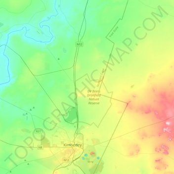
Name: Sol Plaatje Ward 28 topographic map, elevation, terrain.
Average elevation: 1,186 m
Minimum elevation: 1,091 m
Maximum elevation: 1,407 m
Other topographic maps
Click on a map to view its topography, its elevation and its terrain.
Kamfers Dam
RSA > Northern Cape > Sol Plaatje Local Municipality
Kamfers Dam, Transvaal, Sol Plaatje Ward 28, Sol Plaatje Local Municipality, Frances Baard District Municipality, Northern Cape, RSA
Average elevation: 1,163 m