
Raleigh County topographic map
Interactive map
Click on the map to display elevation.
About this map
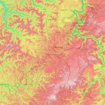
Name: Raleigh County topographic map, elevation, terrain.
Location: Raleigh County, West Virginia, USA (37.50840 -81.56993 37.99248 -80.87746)
Average elevation: 679 m
Minimum elevation: 240 m
Maximum elevation: 1,073 m
Other topographic maps
Click on a map to view its topography, its elevation and its terrain.
Welch
USA > West Virginia > Welch
Welch, McDowell County, West Virginia, 24801, USA
Average elevation: 548 m
Seneca Rocks
USA > West Virginia > Seneca Rocks
Seneca Rocks, Pendleton County, West Virginia, 26884, USA
Average elevation: 638 m