
Hood River topographic map
Interactive map
Click on the map to display elevation.
About this map
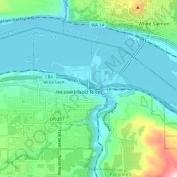
Name: Hood River topographic map, elevation, terrain.
Average elevation: 112 m
Minimum elevation: 14 m
Maximum elevation: 504 m
Temperatures for the year as a whole are slightly cooler than most other low-elevation towns in the region, especially at night due to air drainage off the surrounding mountains. As a rule of thumb, Hood River temperatures are similar to those of Portland in the summer, but more like The Dalles in the winter.