
Hwange National Park topographic map
Interactive map
Click on the map to display elevation.
About this map
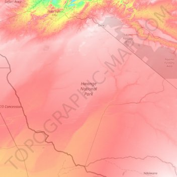
Name: Hwange National Park topographic map, elevation, terrain.
Location: Hwange National Park, Hwange, Matabeleland North, Zimbabwe (-19.88950 25.77625 -18.48707 27.46493)
Average elevation: 1,000 m
Minimum elevation: 740 m
Maximum elevation: 1,134 m
Other topographic maps
Click on a map to view its topography, its elevation and its terrain.
Zambezi River
Zambezi River, Binga, Matabeleland North, 00236, Zimbabwe
Average elevation: 1,017 m
Hwange
Hwange, Matabeleland North, 00236, Zimbabwe
Average elevation: 968 m
Tsholotsho
Tsholotsho, Matabeleland North, Zimbabwe
Average elevation: 1,047 m
Victoria Falls
Victoria Falls, Hwange, Matabeleland North, 00236, Zimbabwe
Average elevation: 877 m