
Idukki topographic map
Interactive map
Click on the map to display elevation.
About this map
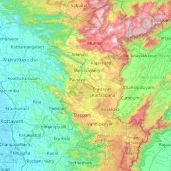
Name: Idukki topographic map, elevation, terrain.
Location: Idukki, Kerala, India (9.27253 76.62792 10.35786 77.41194)
Average elevation: 599 m
Minimum elevation: -3 m
Maximum elevation: 2,644 m
Other topographic maps
Click on a map to view its topography, its elevation and its terrain.