
Yangon topographic map
Interactive map
Click on the map to display elevation.
About this map
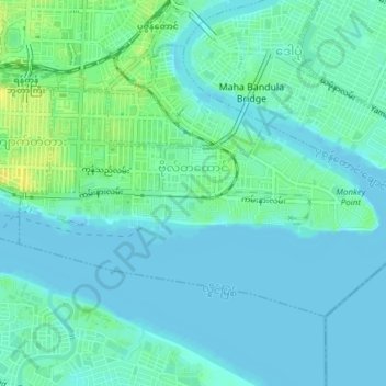
Name: Yangon topographic map, elevation, terrain.
Location: Botahtaung, Eastern District, Yangon, 11162, Myanmar (16.75767 96.16417 16.78092 96.20204)
Average elevation: 6 m
Minimum elevation: -2 m
Maximum elevation: 22 m
Other topographic maps
Click on a map to view its topography, its elevation and its terrain.