
Borgou topographic map
Interactive map
Click on the map to display elevation.
About this map
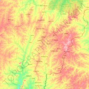
Name: Borgou topographic map, elevation, terrain.
Location: Borgou, Benin (8.74743 1.96972 10.65059 3.84515)
Average elevation: 348 m
Minimum elevation: 215 m
Maximum elevation: 563 m
Other topographic maps
Click on a map to view its topography, its elevation and its terrain.