
Bloemhof Dam topographic map
Interactive map
Click on the map to display elevation.
About this map
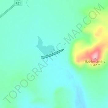
Name: Bloemhof Dam topographic map, elevation, terrain.
Average elevation: 1,152 m
Minimum elevation: 1,102 m
Maximum elevation: 1,331 m
Other topographic maps
Click on a map to view its topography, its elevation and its terrain.
Camdeboo Ward 1
South Africa > Eastern Cape > Sarah Baartman District Municipality > Camdeboo Local Municipality
Average elevation: 955 m
New Bethesda
South Africa > Eastern Cape > Sarah Baartman District Municipality > Camdeboo Local Municipality
Average elevation: 1,417 m
Graaff-Reinet
South Africa > Eastern Cape > Sarah Baartman District Municipality > Camdeboo Local Municipality
Average elevation: 873 m
Valley of Desolation
South Africa > Eastern Cape > Sarah Baartman District Municipality > Camdeboo Local Municipality
Average elevation: 1,092 m